
Hurricane Milton is set to make landfall late Wednesday or early Thursday in the Tampa, Fla., region after undergoing a rapid intensification this week that saw it become the third-fastest storm on record to reach Category 5 status, the most extreme classification on the hurricane scale.
Less than two weeks earlier, Hurricane Helene escalated in a similarly short time span in the Gulf of Mexico before ravaging the southeastern U.S.
The warming climate has been a large factor in these storms’ high intensity, as well as the pace of their intensification — and if temperatures continue to rise, future storms could gain strength faster than the communities in their path can prepare for them.
“There are a number of metrics by which both of these storms are either the most intense or most rapidly intensifying storm we’ve seen in this region,” said Daniel Swain, a climate scientist at the University of California, Los Angeles who researches the dynamics of extreme weather events.
In Helene’s case, Swain said, that meant an unprecedented storm surge and inland amount of rainfall, much of which had its most dramatic effect on western North Carolina. In Milton’s, he noted the storm strengthened to Category 5 “almost literally overnight.”
While climate change does not appear to be increasing the overall frequency of storms, warming oceans are turbocharging their intensity, said Andra Garner, an associate professor in the department of environmental science at Rowan University.
“What we’ve seen in recent years is our ocean waters are warmer than usual, including the Gulf [of Mexico], where we’ve seen Milton really explode in intensity the last few days,” Garner told The Hill. “When we warm the planet with human-caused greenhouse gases, a lot of that excess warmth — about 90 percent of it — goes into the oceans.”
Garner said those warmer temperatures increase the risk of a larger percentage of hurricanes reaching Category 4 or 5 status, as well as making it more likely that they intensify unusually quickly like Milton did.
As storms gather warm water and air, they store it as energy that they later release once they hit. The warm temperatures, she said, allow the storm to gather that energy more quickly.
“Another thing is that when you have a bigger difference between the surface temperature and the temperature higher in the atmosphere, it allows the air to rise more quickly” — an environment that allows for “more violent thunderstorm development,” she added.
Storms’ rates of intensification, or the time it takes for hurricanes’ winds to reach stronger categories, “are dictated by how much potential energy the ocean has in it for hurricanes to draw upon, which is directly the function of a warmth of the ocean,” Swain said.
In Garner’s own research, she said, “we are seeing noticeable increases in how quickly storms strengthen compared to a couple decades ago — how common it is to strengthen from a fairly week storm to Category 3 or greater in a couple hours has become much likelier since 2001.”
The trend is on full display in these two most recent storms, but it’s been similarly apparent in recent years, said Michael Mann, director of the Center for Science, Sustainability and the Media at the University of Pennsylvania.
“The most intense storms on record globally, as measured by peak winds (Patricia in the Pacific with 215 mph) and in both hemispheres, and both the Pacific and Atlantic, have happened with the past decade,” Mann told The Hill in an email. “That’s not a coincidence. We’re seeing a trend toward more intense hurricanes as oceans continue to heat up due to human-caused warming.”
On average, Mann said, the strongest storms have seen their maximum sustained winds increase roughly 10 percent, which translates to an increase of about one-third in their destructive potential.
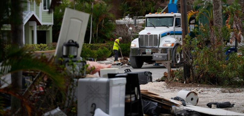
The human and financial cost of Milton remains to be seen, but Helene killed at least 200 people and did billions of dollars in property damage, devastating some parts of Appalachia to the point of virtually washing entire towns away.
The result of these cycles of warming and intensification in the longer term, Swain said, is that the “ceiling” for storm intensity is rising, and more and more storms are hitting that ceiling.
“We’re already seeing a trend toward faster intensification of hurricanes, [and] how much more that will happen is going to depend on how much more warming there is,” he said. “Irrespective of the rate, one of the strongest expectations in a warming climate is we’ll see more of the strongest storms.”
The one-two punch of the storms come as the Biden administration has set ambitious goals to keep warming below 1.5 degrees Celsius above preindustrial levels, the ceiling identified in the Paris Climate Agreement to avert the worst impacts of climate change.
However, research from the World Meteorological Organization published in June suggested global temperatures are on track to exceed that benchmark temporarily in the next five years.
Garner said the anxiety around the hurricanes and their devastation should strengthen the commitment to addressing the problem rather than being cause for despair.
“One thing I always tell people, especially when we see storms like Milton or Helene, [is] it can feel very overwhelming, it can feel kind of hopeless — to that I would say there is some hope we can also solve this problem since we’ve played such a role in causing it,” she said. “There is hope that if we take action, we can prevent this problem from getting worse in the future, but that hope relies on really meaningful action.”