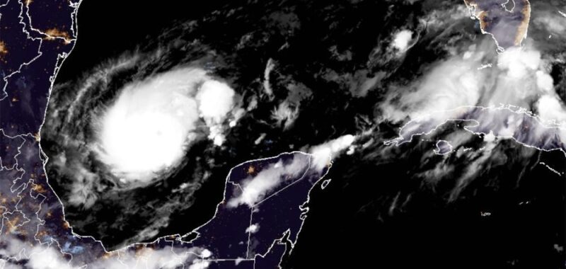

The nation’s eyes are on Florida as Hurricane Milton seems poised to strike the state this week — nearly two weeks after experiencing the destruction of Hurricane Helene.
Residents of the Sunshine State are no strangers to hurricanes, but experts are sounding the alarm over Milton. The storm rapidly intensified into a Category 5 hurricane Monday, only one day after it officially became a hurricane, and “is expected to grow in size and remain an extremely dangerous hurricane when it approaches the west coast of Florida on Wednesday,” according to the National Hurricane Center (NHC).
Here’s why experts are concerned about the storm.
Rapid intensification
The storm officially became a hurricane Sunday, according to the NHC, and on Monday, it had already intensified into a Category 5 hurricane. Rapid intensification, per the NHC, is when “the maximum sustained winds of a tropical cyclone” rise “at least 30 knots in a 24 hour period[.]” Thirty knots is equal to just below 35 miles per hour (mph).
“This is what rapid intensification looks like, going to sleep to a meh category 1 hurricane & waking up to a monster category 5 with 160 mph winds,” CNN meteorologist Elisa Raffa said in a post on the social platform X Monday that featured maps with Milton.
“Truly mind-boggling & scary,” Raffa continued in her post. “This is the trend as our oceans continue to trap heat & fuel stronger storms.”
The science nonprofit Climate Central noted Milton’s rapid intensification in a thread on X Monday, stating that oceans rising in temperature “due to human-caused climate change, are fueling stronger tropical cyclones.”
“#Milton rapidly intensified over sea surface temperatures in the Western Gulf of Mexico, which have been made hundreds of times more likely to be anomalously warm due to climate change,” Climate Central said later in the thread.
A Florida meteorologist who recently got emotional when talking about the severity of Milton said that the Gulf of Mexico, where the storm is currently located, has waters that are “so incredibly hot.”
“You know what’s driving that, I don’t have to tell you … global warming, climate change leading to this and becoming an increasing threat,” John Morales said.
Risk of damage
The NHC said in a forecast discussion Monday that “Milton is expected to grow in size and remain an extremely dangerous hurricane when it approaches the west coast of Florida on Wednesday.”
“A large area of destructive storm surge will occur along parts of the west coast of Florida on Wednesday,” the agency continued. “This is an extremely life-threatening situation, and residents in those areas should follow advice given by local officials and evacuate immediately if told to do so.”
Beyond the storm surge, the NHC also said that possibly “devastating hurricane-force winds are expected along portions of the west coast of Florida where a Hurricane Warning is in effect” and that zones “of heavy rainfall will impact portions of Florida today well ahead of Milton, with heavy rainfall more directly related to the system expected later on Tuesday through Wednesday night.”
“This rainfall will bring the risk of considerable flash, urban, and areal flooding, along with the potential for moderate to major river flooding,” the agency continued.
Bryan Bennett, a Tampa-area meteorologist, said in a post on X Monday that Milton “COULD BE OUR KATRINA,” referencing the cataclysmic 2004 storm that caused mass destruction in New Orleans.
“Winds rotate counterclockwise around a hurricane,” Bennett said. “If the storm makes landfall in Pasco [County] or Pinellas [County], not only will it significantly flood [Clearwater] & St. Petersburg, but much of south Tampa, MacDill [Air Force Base], & downtown Tampa may go underwater.”
Bennett also said when the storm makes landfall, “winds are going to be sustained around 125, gusting to 155 mph,” adding that a wind speed at “150 mph wind is strong enough to take off a roof and damage exterior walls of a well built home.”
“I typically try to keep my message calm & low key,” Bennett said in his post. “But, the potential devastation that this storm may cause is the reason for my concern/worry for my home -Tampa Bay. That is also why I am pushing for so many people to please evacuate.”